The government yesterday approved the legislative framework for & nbsp; the creation of a public company (PPK) Roskadastr. She & nbsp; will have to deal with the digitalization of all spatial data in & nbsp; RF and & nbsp; provide the state with the full range of services in & nbsp; land and & nbsp; real estate.
As explained to Kommersant in Rosreestr, we are talking about creating a “one window” system for all users of spatial and cartographic data.
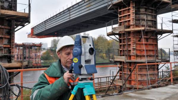
Creation of Roskadastra it took for & nbsp; implementation of the state program “ National Spatial Data System '', adopted in & nbsp; September and & nbsp; calculated for & nbsp; 2022 & minus; 2030, they say in the & nbsp; department.
The state program, we recall, involves the launch of a unified electronic cartographic system and & nbsp; federal portal of spatial data & nbsp; & mdash; de facto we are talking about & nbsp; creating a multi-layer digital map of Russia. All project data must be structured and & nbsp; available to citizens, businesses and & nbsp; government agencies depending on & nbsp; the clearance level.
The project must eliminate the problem with the lack of complete data on land and real estate in Russia, which the authorities have been trying to solve for more than ten years …
This is hindered by both insufficient funding and & nbsp; fragmented government. The project approved yesterday aims to solve both problems.
PPK Roskadastr created on the & nbsp; basis of federal state budgetary institutions “ FKP Rosreestr '' and & nbsp; & quot; Center for Geodesy, Cartography & & nbsp; Spatial Data & quot; and & nbsp; Joint Stock Companies Rostekhinventarizatsiya & nbsp; & mdash; BTI '' and & nbsp; Roscartography. Now their & nbsp; functions are often duplicated, they explain in the & nbsp; Rosreestr, while & nbsp; and the powers of the structures are limited to industry specifics, which & nbsp; impedes the implementation of large-scale plans of the government for & nbsp; digitalization of geodata.
After the reorganization of structures in & nbsp; 2022, all powers will withdraw PPK “ Roskadastr '' that & nbsp; will increase manageability in & nbsp; this area, & nbsp; & mdash; while the management system is characterized as “ fragmented and & nbsp; cumbersome '', it is indicated in the & nbsp; explanatory note to the & nbsp; project.
The company will be subordinate to Rosreestr, the supervisory board will be headed by Deputy Prime Minister Marat Khusnullin, supervising the department.
From the & nbsp; project it follows that & nbsp; PPK “ Roskadastr '' will become a full-cycle company in & nbsp; this area and & nbsp; will enter into the Unified State Register of Real Estate information about & nbsp; borders, geodetic and & nbsp; cartographic works, the creation of state topographic maps and & nbsp; topographic plans, scientific and & nbsp; research activities.
The company will develop and & nbsp; implement electronic services of Rosreestr, and & nbsp; also provide these services. In addition, PPK is assigned to the implementation of projects with & nbsp; private companies in the & nbsp; sphere of development of information technology, geodesy, cartography, spatial data and & nbsp; information security. At the same time, public legal status will allow Roskadastr engage in commercial activities and & nbsp; channel revenues from & nbsp; it into & nbsp; development of a spatial data system.
The new structure will ensure the interaction of the industry with the regulator and relieve Rosreestr as a department of economic functions.
Practice for & nbsp; creating a “ buffer '' organizations between the market and the & nbsp; regulator & nbsp; are already being implemented, for example, the Ministry of Economy, which required the creation of & nbsp; JSC SME Corporation for & nbsp; providing support to small businesses and & nbsp; interaction with & nbsp; companies, and & nbsp; also the Ministry of Natural Resources & nbsp; & mdash; we are talking about & nbsp; PPK “ Russian ecological operator '', responsible for & nbsp; environmental monitoring and & nbsp; regional operators for & nbsp; & nbsp; waste management.
In & nbsp; Rosreestr indicate that & nbsp; the created system of “ one window '' will reduce the time for the provision of services and & nbsp; increase the number of departmental services in & nbsp; electronic form, increase the efficiency of land use and & nbsp; involve territories for & nbsp; housing construction. & Nbsp; agree with & nbsp; experts.
Spatial data is now fragmented. There is no complete and & nbsp; accurate base, which & nbsp; negatively affects the & nbsp; industry of geodesy and & nbsp; cartography and & nbsp; & nbsp; related industries. There is an acute problem of degradation of the state geodetic network, which is the foundation for & nbsp; production of topographic surveys, geodetic support of various engineering works. A unified geospatial data platform will help you do high-quality analytics with & nbsp; the use of new technologies. This is a request and & nbsp; science, and & nbsp; business, and & nbsp; authorities & raquo;, & nbsp; & mdash; believes the President of the Russian Academy of Sciences Alexander Sergeev.
According to the & nbsp; opinion of the President of the Association “ National Association of Housing Developers '' Leonid Kazintsa, the implementation of the state program will have a positive effect on the & nbsp; development of the real estate market: “ The procedure for placing objects on the & nbsp; state cadastral registration is simplified, administrative barriers are reduced, interaction is transferred to & nbsp; electronic format, which & nbsp; significantly reduces the time frame for registration and registration actions. '' >
Diana Galieva